Aug 18-22
When I first heard the name Germfask, I immediately thought it has a Germanic origin, but that's not the case. The name was derived from the first character of the surname of the original founders (Grant, Edge, Robinson, Mead, French, Ackley, Sheppard and Knaggs).
Here's some links to more information about Germfask MI and some photos of the area.
Here's a link to the below map for easier reading.
When we go to a new location we always check for any campgrounds in the area that offer a discount from one of the clubs we belong to. We chose Big Cedar Campground, right in Germfask and just 3 miles form the Seney welcome center. Big Cedar is a nice park and Barry and Tanya Peters are very accomodating, offering us our choice of a couple campsites. We chose #39, a grassy site with some nice shade trees and near the bathhouse.
We forgot to take a picture of our campsite. So, here's one from from the Big Cedar Campground web site. We were in the site nearest the camera with the silver truck/with topper.
The campground is on the Manistique river and we arranged shuttle with Berry for a canoe trip in the next few days. But, the main draw to the area was Seney Wildlife Refuge. The weather forcase was mixed, but even if it rained, we'd be able to enjoy the refuge from our truck on the driving tour. After we got setup, we drove the 3 miles to the welcome center. Our timing was good. The next evening (Wednesday) there was a guided bus tour through the refuge on some of the back roads not open to normal car trafic. We jumped at that oppurtunity and quickly signed up. We also got a map showing the bike route so we were ready when we had a nice weather day.
Aug 19
Wednesday dawned cloudy but we were eager to drive through the Refuge.
 |
| View from the begining of the driving tour road |
 |
| Weather was threating all day but we didn't get any rain. |
 |
| Sandhill cranes and Canada Geese. |
 |
| Swans white feathers are stained by red minerals in the water. |
The guided tour began at 6:00pm and the weather hadn't improved. We saw more wild life during our drive earlier in the day but we did get to see our first loon.
 |
| All the clouds made for a colorfull sunset. |
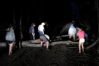
It turned dark before the guided tour ended. As we turned onto the road leading back to the welcome center, an ominous form appeared on the road ahead. A tree had fallen across the pitch black road. At first the rangers tried to cut a path with meger hand tools. When it became obvious that wasn't going to work, everyone pitched in and the road was clear in no time. Ah, the power of team work!
Thursday was much like the previous few days, cloudy and cool but no wind. Actually, it was very calm and peaceful.
 |
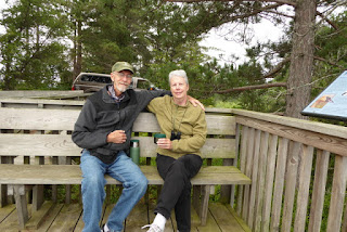
| Planning ahead, we brought a thermos full of hot chocolate. It really hit the spot on a cool morning! |
 |
| We saw lots of beaver trails, but no beaver. |
Aug 21
Finally, a good weather day and we planned to take full advantage of it. We were up early for a quick drive through the Reserve, without clouds.


The Jolly Inn (restaurant and bar) was recommended by the locals, so we stopped in for a late breakfast. At 10:15am, we pretty much had the place to ourselves.

When our breakfast arived it was amazing. We ate our fill and had enough potatos and bacon left over for two more meals.

After Breakfast, we went back to the camper and geared up for a bike ride. The entrance to the bike route was right across M-77 from our campground. We could have ridden from the campsite but there was a rather steep hill leading to the trail head. So, we put our bike rack on the truck and drove the short distance. We wanted to save our energy for the more senic ride in the refuge. It's a good thing we did!
The route had a road leading out and one leading back forming a pie shape.with the small end near the trail head. There's two short cuts and a main road (M-28, across the river) connecting the wide end of the pie. Our plan was to ride to the first short cut and connect to the inbound road, a ride of about 7 miles.

It really turned into a beautiful day! The ride out was truly spectacular. The road was hard packed with little elevation change, almost like riding on pavement.

The first short cut was a little hard to find. We had to ride past it a couple of times before we figured out where it was. It obviously wasn't used very much because it was so overgrown. After riding these nice open roads, riding through the weeds wasn't very appealing. It was a beautiful day and we were feeling good so we decided to ride to the the next shortcut.

We got to the second shortcut and it wasn't much better then the first. M-28 was just across the river and we still felt strong so we moved on to ride the full trail.

While the terrain on M-28 was nice, it wasn't as pretty as the gorgeous scenery we'd been riding through. The road was flat and smooth and we were making good time.
When we were about as far from the trail head as we could get, we started thinking we'd bitten off more than we could chew. Oh well, all we could do was push on and take more breaks.
 |
| The first leaf of fall... in August. |

The road heading back toward the trailhead was mostly through forest, much different from the road out.
At about 12 miles we hit a wall (figuratively). We pulled off the road, found a nice quiet spot and took a break.
Wind blowing through the trees during a
break on the bike ride.
After about a half hour break, a snack and some water, we pushed on. This leg of the trail had some up hills. We were too tired to ride so we just got off our bikes and walked till we crested the hills.
 |
| Don't believe that max speed! |
After over 4 hours and 17 miles we were back at the trail head, very tired.
***
It was late afternoon and after a shower and a little rest we headed back to the Refuge for one last drive through. Not much wild life but there was a pretty sunset to cap off a busy and enjoyable day.
Aug 22
It was our last day in Germfesk and Seney. The weather was good but not as nice as the previous day. We'd scheduled a shuttle with Berry for a paddle on the Manistugue River. The launch was right in the campground. That made it nice since we could run the shuttle early and start our paddle whenever we were ready. After the strenuous day we had yesterday, we weren't in any mood the get active early.
 |
| View down stream from the Big Cedar Campground |
Right off the bat, the river makes a left turn and there's a small rapid. About a quarter mile downstream, the river makes a right under the M-77 bridge and into the Seney Refuge.

Coming soon, Munising and the Pictured Rocks National Lake Shore


No comments:
Post a Comment