Sunday, January 17, 2016

Seney Wildlife Refuge

Aug 18-22

Somewhere in our travels we picked up a brochure for the Seney Wildlife Refuge. After a little investigation, it sounded like a place we'd like to visit. There's a 7 mile driving tour, a 1.4 mile nature trail, biking trails and a canoe trail on the Manistique River. The route runs about 60 miles from Muskalonge Lake State Park south west of Newberry, MI to the town of Germfask, MI.

When I first heard the name Germfask, I immediately thought it has a Germanic origin, but that's not the case. The name was derived from the first character of the surname of the original founders (Grant, Edge, Robinson, Mead, French, Ackley, Sheppard and Knaggs).

Here's some links to more information about Germfask MI and some photos of the area.

Here's a link to the below map for easier reading.


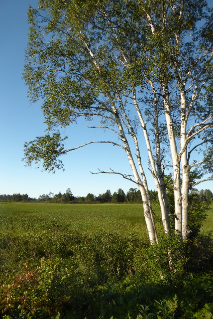
When we go to a new location we always check for any campgrounds in the area that offer a discount from one of the clubs we belong to.  We chose Big Cedar Campground, right in Germfask and just 3 miles form the Seney welcome center. Big Cedar is a nice park and Barry and Tanya Peters are very accomodating, offering us our choice of a couple campsites.  We chose #39, a grassy site with some nice shade trees and near the bathhouse.
We forgot to take a picture of our campsite.  So, here's one from from the Big Cedar Campground web site.  We were in the site nearest the camera with the silver truck/with topper. 


The campground is on the Manistique river and we arranged shuttle with Berry for a canoe trip in the next few days. But, the main draw to the area was Seney Wildlife Refuge.  The weather forcase was mixed, but even if it rained, we'd be able to enjoy the refuge from our truck on the driving tour.  After we got setup, we drove the 3 miles to the welcome center. Our timing was good.  The next evening (Wednesday) there was a guided bus tour through the refuge on some of the back roads not open to normal car trafic. We jumped at that oppurtunity and quickly signed up. We also got a map showing the bike route so we were ready when we had a nice weather day.

Aug 19

Wednesday dawned cloudy but we were eager to drive through the Refuge.


View from the begining of the driving tour road


Weather was threating all day but we didn't get any rain.


Sandhill cranes and Canada Geese.


Swans white feathers are stained by red minerals in the water.

The guided tour began at 6:00pm and the weather hadn't improved.  We saw more wild life during our drive earlier in the day but we did get to see our first loon.


All the clouds made for a colorfull sunset.

It turned dark before the guided tour ended.  As we turned onto the road leading back to the welcome center, an ominous form appeared on the road ahead.  A tree had fallen across the pitch black road.  At first the rangers tried to cut a path with meger hand tools.  When it became obvious that wasn't going to work, everyone pitched in and the road was clear in no time. Ah, the power of team work!


Aug 20

Thursday was much like the previous few days, cloudy and cool but no wind.  Actually, it was very calm and peaceful.


Planning ahead, we brought a thermos full of  hot chocolate.
It really hit the spot on a cool morning!

We saw lots of  beaver trails, but no beaver.

Aug 21

Finally, a good weather day and we planned to take full advantage of it. We were up early for a quick drive through the Reserve, without clouds.


The Jolly Inn (restaurant and bar) was recommended by the locals, so we stopped in for a late breakfast.  At 10:15am, we pretty much had the place to ourselves.


When our breakfast arived it was amazing.  We ate our fill and had enough potatos and bacon left over for two more meals.


After Breakfast, we went back to the camper and geared up for a bike ride.  The entrance to the bike route was right across M-77 from our campground.  We could have ridden from the campsite but there was a rather steep hill leading to the trail head.  So, we put our bike rack on the truck and drove the short distance.  We wanted to save our energy for the more senic ride in the refuge. It's a good thing we did!

The route had a road leading out and one leading back forming a pie shape.with the small end near the trail head.  There's two short cuts and a main road (M-28, across the river) connecting the wide end of the pie.  Our plan was to ride to the first short cut and connect to the inbound road, a ride of about 7 miles.


It really turned into a beautiful day!  The ride out was truly spectacular. The road was hard packed with little elevation change, almost like riding on pavement.


The first short cut was a little hard to find.  We had to ride past it a couple of times before we figured out where it was.  It obviously wasn't used very much because it was so overgrown.  After riding these nice open roads, riding through the weeds wasn't very appealing.  It was a beautiful day and we were feeling good so we decided to ride to the the next shortcut.


We got to the second shortcut and it wasn't much better then the first.  M-28 was just across the river and we still felt strong so we moved on to ride the full trail.


While the terrain on M-28 was nice, it wasn't as pretty as the gorgeous scenery we'd been riding through.  The road was flat and smooth and we were making good time.

When we were about as far from the trail head as we could get,  we started thinking we'd bitten off more than we could chew.  Oh well, all we could do was push on and take more breaks.

The first leaf of fall... in August.


The road heading back toward the trailhead was mostly through forest, much different from the road out.


At about 12 miles we hit a wall (figuratively). We pulled off the road, found a nice quiet spot and took a break.


Wind blowing through the trees during a 
break on the bike ride.

After about a half hour break, a snack and some water, we pushed on.  This leg of the trail had some up hills. We were too tired to ride so we just got off our bikes and walked till we crested the hills.

Don't believe that max speed!

After over 4 hours and 17 miles we were back at the trail head, very tired.

***

It was late afternoon and after a shower and a little rest we headed back to the Refuge for one last drive through.  Not much wild life but there was a pretty sunset to cap off a busy and enjoyable day.


Aug 22

It was our last day in Germfesk and Seney.  The weather was good but not as nice as the previous day. We'd scheduled a shuttle with Berry for a paddle on the Manistugue River.  The launch was right in the campground.  That made it nice since we could run the shuttle early and start our paddle whenever we were ready.  After the strenuous day we had yesterday, we weren't in any mood the get active early.

View down stream from the Big Cedar Campground

Right off the bat, the river makes a left turn and there's a small rapid.  About a quarter mile downstream, the river makes a right under the M-77 bridge and into the Seney Refuge.


 We had a really good time in Germfesk and the Seney Wildlife Refuge, in spite of the weather.  We'd done everything there was to do at Seney except the 1.4 mile nature trail around the visitors center. Next time we come this way, we'll start with that little walk, if the weather's good.

Coming soon, Munising and the Pictured Rocks National Lake Shore

Friday, January 8, 2016

Muskallonge Lake State Park

Aug 14-17 2015
On Friday we headed toward Muskallonge Lake State Park where we had reservations through the weekend, a trip of about 60 miles.

The route re-traced our drives over the last few days, through Paradise MI and past the Lower and  Upper falls.  Beyond was "Virgin Territory", our term for roads we've never traveled. These short trips between campsites became our pattern while touring the U.P.  We'd camp for a few days, explore the area, travel another 30-60 miles and explore a new area.  This stop had been planned way back in July when we decided to head to the U.P.  On the map it seemed to be in the center of many of the "must see things in the U.P." locations.  Once we got in the area we found it was just out in "the middle of nowhere".  But, that's our kind of place, we've been living in "the middle of nowhere" (Salt Springs, FL) for the past 22 years.

The drive in was interesting, the two lane road (M-407) wound through forests with a spattering of homes/businesses and criss-crossed by ATV/Snow Mobile trails. This is where we started noticing the off road trails that honey-combed the U.P.  Muskallonge Lake State Park is literally at the end of the road, the paved road that is, just past the little community of Deer Park, MI. M-407 continues for about 17 miles toward Grand Marais MI but it's a gravel road. In the area around the park, there are only two "convenience type" stores, a small laundromat, an Inn or two and a few bars.  To do any real shopping you have to drive 27 miles to Newberry, MI.

Laundromat in Newberry MI
On the way to the campground, we stopped in Newberry to do our laundry, thinking there wasn't a laundromat in the remote area that we were heading.  As has become our practice when stopping in town while towing, we used Google Maps to scout out the approach, parking, and exit. We lucked out and got a easy parking spot right in front. After starting the washing machines we walked one block north to an IGA grocery store to stock up with food, a very efficient use of time.  While all the logistics worked out, it became an expensive stop. We paid $4 a load in Newberry, the most all summer.  At he little laundromat in Deer Park, it cost only $1.25.

The park is located on a strip of land between Muskallonge Lake and the Lake Superior shore.
Our campsite (#72) was in an awkward spot for a rig our size.  There were trees and posts in all the wrong places. To make things worse we were right on the concrete path leading to the bath house, so we had an audience.  Think of sitting at a busy boat ramp on a holiday weekend and waiting for things to go wrong.

We were trying to place the camper in the back of the site with clearance for the awning, the slide out and still have the truck out of the road while hooking and un-hooking. To do this we had to pull into the campsite of the very gracious neighbor across from our site.  We thought we had everything just right and had unhooked the camper from the truck.  Then we found the awning was going to hit a tree by about 2 inches. We were facing south and it was pretty warm, even for this Florida boy, and we didn't want to go without the awning.  We re-hooked the camper and moved it forward about 3 inches! Well at least we were able to bring a little chuckle into the lives of the surrounding campers.  A few days later, we got to sit (in the shade of our awning) and watch another poor soul go through a similar delimit in the site just across the path from us.
Here's a link to a YouTube video of aerial photos of the park and surrounding area.

***
After getting setup, we took a drive around the area to see what there was to see.  One of the two general sores is located just past the pavement on the road toward Grand Marais.  It's a little "A" frame store front with the living quarters behind.  As we walked in the door, a disembodied voice greeted us saying he'd be right there. They had a little bit of everything the camper or hiker might need (the store is right on the North Country Trail).  Bob sat behind the small register beside the front door. While grocery shopping in Newberry, we neglected to get tomatoes.  So, on the off chance, we asked Bob if he had a tomato for sale.  No, he said, they don't keep "fresh" produce in the store because it goes bad before he could sell it.  But, he went on to say, a friend brought him a bunch of tomatoes form his garden and he'd give us one.  No, we said, but he insisted and retreated  behind the store emerging with a nice ripe tomato.  We stayed awhile asking questions about the area, Bob had lots of stores to tell.  He and his wife had lived there for many years (over 30, can't remember exactly). Looking around for something to buy, Joan spied a bottle of Red Moscato. We weren't familiar with that wine but decided to give it a try.  We were getting tired of the Pinot Grigio we'd been drinking. Later during our stay, Joan made some cookies and we took some to Bob and his wife.

Note to self:  Take more pictures and notes about the people we meet...  I can see Bob sitting behind the small register with pictures and memorabilia on the wall behind him.  Unfortunately, I can't imprint my memories into the blog.

***
To get from the park to Lake Superior you walk across M-407 and down a board walk to the beach. The beach is made up of millions of small polished rocks at the waters edge that turns into sand as you get further back from the shoreline.  There are Rock Hounds everywhere and a popular pass time is searching the shore for beautiful Lake Superior Agates.  Carrying a load of rocks across the U.P. wasn't on our agenda so we just waked the beach and enjoyed the moment,  while the weather was good.  There were some really beautiful days, and some cold windy gray days.


The beach is sooooo crowded with rocks, they are
climbing the trees to try to escape the crush of minerals. 
(really Joan was just sitting in the shade playing with the rocks)


Lake Superior Gold prospectors

Another interesting activity on the beach is gold prospecting. We saw all sorts of rigs complete with sluice boxes, water pumps and the means for transporting them from the parking area to the beach.  The picture to the right shows one fellow using a 2 wheeled cart and the other with a sled he drags down the trail then floats to the desired location.  Apparently the gold is contained in the black sand layer that's eroded from the shore during storms. Here's a couple of videos that explain it much better than I can.
Lake Superior Gold video-1, video-2.
Here's a link to some other interesting Lake Superior Facts.

Aug 15
One particularly warm sunny day we walked the short park trails that connects to the North Country Trail.

The NCT runs from it's connection to the Appalatch1an trail in Vermont  through Ohio, Indiana, Michigan, Wisconsin and North Dakota.  All through Michigan we kept seeing references to the NCT and in the U.P. we crossed it's path many times.  A small section runs through Muskallonge Lake State Park along the high bluffs overlooking Lake Superior.

The park trail has benches set at strategic locations and (not being in any hurry) we stopped on a nice shady one and simply enjoyed the perfect temperature, peace and quiet. It was so relaxing, Joan stretched out and took a short nap and Rick nodded off sitting up right.

After our little snooze, we pressed on to "find the North Country Trail".  It wasn't hard, the park trail connected to the NCT on a high bluff overlooking Lake Superior and one of the prettiest views yet this summer.  To the right was an orange barrier indicating the trail was closed due to erosion.  A shame, it would have made a wonderful walk with views like this.  We headed left along the bluff and eventually into the woods.


On the North Country Trail 


Wildlife (Red Squirrels, smaller and more
aggressive than our gray squirrels)


***

Later that day we went exploring the area to the east of the park.  The only paved road in the area is M-407 so we started down one of the dirt roads leading into the forest.  The GPS and paper maps didn't have much detail on these forest roads so we just kept driving (about 5 miles) till we hit a road that was on the map, County Road 410 E.  The road we had been on lead basically north east.  Turning west on 410 E headed back toward the paved road and the park. The map also indicated we'd be crossing the Two Hearted River.

Hemingway fans might remember his short story Big Two-Hearted River.  In 1919, Hemingway and two high school friends went on a week-long fishing and camping trip near Seney, about 60 miles from Deer Park and the Two Hearted River.  That trip became the inspiration for the two-part Big Two-Hearted River story.

We made some inquiries about paddling opportunities and the Two Hearted River was mentioned along with the name of an outfitter who would do the shuttle.  I called the outfitter and the charge was $40 from the Red And Green put-in to the mouth of the river on Lake Superior.  We decided to skip the full river trip for a number of reasons.  It hadn't rained in a long time and there would be a long shuttle on dusty dirt roads and we thought the price for the shuttle was a little high.  What we decided to do was put in at the Red And Green launch and paddle up stream as far as we could (or wanted to) and then float back.

Here's a link to a canoe trip report on the Two Hearted river from 2006.

Aug 16

We headed out on our no shuttle exploration of the Two Hearted River.  It still hadn't rained in a while and it was proving to be a hot dusty ride.  When we arrived, I discovered I'd left the back window to the truck topper open and everything in the bed of the truck was covered in dust.  Oh well, nothing I can do about it now.  We unloaded the boat and gear and headed for the put-in.


Red And Green put-in on right bank as seen
 from the 410 E bridge
The Red And Green put-in is on the north west bank next to the 410 E bridge.  There's a nice canoe launch ramp made out of gravel and landscape timbers.  While we were organizing our gear, a family of ATV riders crossed the bridge and stopped for a break. We had a short conversation about the weather etc. I couldn't help thinking that riding that dusty dirt road didn't seem like fun to me, but, to each his own.  They were very friendly and seemed to be having a good time.

We pushed off and started paddling up stream.  The current was swift but nothing we couldn't handle.  After we went around a few bends it became obvious the terrain wasn't as pleasant above the bridge as it was below.  The day was getting very hot with little shade.  While we weren't new to dealing with lift overs, there wasn't much incentive to continue once we reached the first one, we turned around and headed back down stream.


Up stream from the Red And Green put-in

Back down stream to the 410 E bridge


There's a primitive camp about a quarter mile down stream from the bridge, so we decided to paddle down stream till we got the campground then back up stream to the bridge.  If we got to the campground and didn't want to paddle back up stream, we could hike the road back to the truck.  About 200 yards down stream form the bridge, there's a small rapid.  We paddled down then back up the rapid (just to make sure we could) before heading down stream again.  The down stream country side was much prettier, lots of trees and interesting river banks.  After a while we came across another rapid and decided we'd had enough fun for this trip and headed back up stream to the put-in.

We spent the rest of the afternoon back in camp drinking raspberry daiquiris and cleaning all the dust out of the back of the truck.

In retrospect, we should have taken the time and spent the money to run the whole river. But hey, that's something else to put on our list for the next time we visit the U.P.
Sunset on  the beach,
Muskallonge Lake State Park MI

Coming soon, Seney Wildlife Refuge.