Sunday, December 24, 2017

Fall colors in the Chiricahuas

 12/24/2017
Christmas greetings form southern Arizona. 

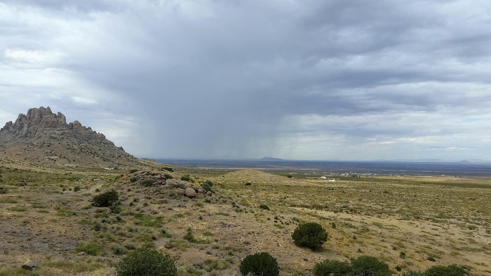
Well I've gotten complacent again an behind of the blog.  We're in Ajo, Az. volunteering for US Fish and Wildlife Service at Cabaza Prieta National Wildlife Refuge.  We'll be here through Feb. 2018.

We hope everyone has a wonderful Christmas.

Here's some fall color pictures from Cave Creek Canyon...

Nov. 2017
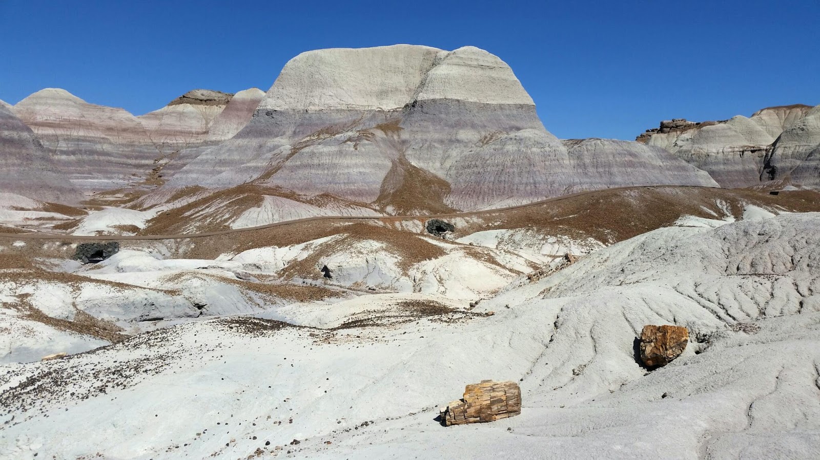
Being from the east, we're use to seeing a whole mountain lit up with colors.  Here in the canyon the predominate color maker is Sycamore which turns yellow in fall. 


About 2 miles up the popular South Fork trail there's a few maple trees recovering from recent fires, flood and disease.  


Coming next, a walk around Ajo, Az.

Friday, November 24, 2017

Back to Cave Creek Canyon, Portal AZ.

November 2017

We first visited Cave Creek Canyon last spring for about 6 weeks starting at the end of April.  We liked it so much we decided to come back for November and the Fall Colors in southeast Arizona.

The nearest town is Portal, AZ.  Life in Portal is pretty basic, a lodge/cafe/store, post office (open 9-12 six days a week) and a library with a great selection of  DVD's, no TV reception.  A lady's club called "Sew What" presents programs once or twice a month as fund raisers.  They sponsor college scholarships for local high school seniors and support a nursing home in Douglas, AZ.  We attended 2 programs while we were here.  One was by a couple that took a trip to South Africa, and the other was a local resident who's a professor at the University of Southern Arizona on the solar electric revolution.

Our job (then and now) is working the Visitors Information Center (aka The VIC) helping visitors enjoy this wonderful oasis in the desert. The building was constructed in 1927 as a ranger station/residence. It's gone through many transformations over the years and in recent decades was unused till 2004 when the Rotary Club from Tucson renovated the old station.


Even after the renovation it lay dormant until the Friends of Cave Creek Canyon entered into an agreement with the US Forest Service to open a visitors center.  By all accounts it's been a great success.  We often get long time visitors who are thrilled that the old ranger station is open again.


Joan, ready to help someone find a great campsite, hiking trail or birding locations.

The Canyon is part of the Chiricahua mountian range, one of a series of "Sky Islands" located throughout southeastern Arizona, southwestern New Mexico and northern Mexico.

This hour long video describes everything you ever wanted to know about the Chiricahua mountains.  The first 2:50 minutes are previews of other videos by the film maker followed by the feature presentation. Watching the video from 2:50 to 14:00 will give a good basic understanding of the Sky Islands. The rest of the video describes the plants and animals found in the Chiricahuas.

The first time I saw the below relief map of the Chiricahuas, I thought it was produced with a 3-D printer. With closer examination it became clear it's origin was much more low-tech.  It was hand-made in 1940 by members of the Works Progress Administration (WPA), part of the New Deal.


Pointing to the Visitors Center location.

We believe the map was created by laying a topo map on a very thin sheet of wood veneer.
Each contour line was cut into the veneer forming one layer.  The procedure continued for each contour line. Once cut, each layer was laid on the previous layer, building to the highest elevation.

  
This is our hiking trail map.
We can print detailed description of trails
as shown below the map in the above picture..

Coming next, Fall colors in the Chiricahuas.


Wednesday, October 25, 2017

Rockhound State Park, NM

10/16/2017

Rockhound State Park is a few miles southeast of Deming, NM.  It sits on the slope of a section of the Little Florida mountains, volcanic in origin.  What's unique about this park is you’re allowed to wander the hill sides and take home up to 15 pounds of rocks ranging from Quartz, Agate, Opal, Jasper to Thundereggs and Geodes.


As is typical of New Mexico State Parks, Rockhound is a very nice park with large landscaped sites at a bargain price, $10 for dry sites and $14 for water/electric. It’s a small campground with 5 dry sites and 19 water/electric, 5 of those are reservable.  We wanted an electric site (forecast was for mid 80’s and the A/C might come in handy)  but none were available.  The camp host guided us to the ONLY site available, #2.  He said he’d let us know if an electric site opened up. We thought this was unusual for a Monday at noon, there’s usually plenty of sites after the weekend.  #2 turned out to be a nice site, backing up high on the hill side with a great view over the campground and the valley beyond.


Campsite #2.

After lunch we walked (down hill) to the visitors center to pay for the site.  As Joan was writing the check, the host walked in and told us an electric site had just opened up, #26.  As we found out, check out time was 2pm, we’d just gotten there too early.  #26 is a first come first serve site so we had to hurry and claim it before someone else beat us to it.  So, now we're hiking at a rapid pace (up hill) to claim #26 and move our camper yet again in the same day.  This pattern of moving multiple times in the same day was continuing from our previous stop at Cattleman Trail.

Campsite #26
10/17/2017

This morning we hiked the Botanical Garden, Thunder Egg and Jasper trails.  All totaled only about 2 miles if you count for the beginning and end of the trails being on opposite ends of the park.


View of the campground and valley beyond from Thunderegg trail.

Cactus Wren nest, no body home.

Can you see the grass hopper?
10/18/2017

Spring Canyon is part of Rockhound but 3 miles up the road.  There’s 2 trails, one easy (a little over a mile) and one harder (a little over 2 miles).  We decided to do the hard one first and then the easy one if we wanted more.  Well, the hard trail was all we could handle.  It was very step and rocky with sections that looked more suited to the Persian Ibex that were gifted to the U.S. from Iran back in 1970 and introduced into these hills..


Looking down canyon toward our starting point
from near the top.
Made it to the top, Wahoo.
Panoramic view of both sides of the mountain.
Driving out of the canyon heading back to the campground.
Storms brewing, it was fun to watch the weather until it
rolled over us.  First REAL rain we've had since leaving Florida in March.
One evening while eating dinner, we saw this strange
phenomenon where there appears to be two suns. 
Coming next, Back to Cave Creek Canyon, Portal AZ.

Tuesday, October 24, 2017

Cattleman Trial - Continental Divide Trail

10/14/2017
After a couple nights at Rose Valley RV Ranch in Silver City, NM to do some shopping and laundry, we headed to another National Forest dispersed camping location about 25 miles southwest of Silver City,  Cattleman Trial.  The main draw for this location, other than a free place to camp for a few days, is the Continental Divide Trail which runs through the campground.

If you read the comments about this location they mention that the best sites are near the road.  Well, we forgot that little piece of information when we arrived.  We passed some sites as we were driving in but preceded on to find something further down the road.  There’s a loop drive at the end of the road with evidence of some campsites.  The terrain has (what appeared to be) a gentle slope.  We picked a spot and started to “try” to setup.  To make a long story short, we spent over an hour trying to make the trailer level in several locations and wasn't comfortable with the stability of any of them.  Disappointed, hot, tired and frustrated, we gave up. As we were driving out, we noticed the sites we’d discounted earlier.  Deciding to give it one more try, we finally got setup, still on a little slope but the camper was level.

Lesson learned, don't try to make a silk purse out of a sows ear!  If it's not right, move on and find something that is.


Still on a slope, but acceptable.

10/15/2017
The next day we hiked a small portion of the Continental Divide Trail, here’s some pictures…


Trail hazard!
View from the top of the hill, our goal for the hike.
Heading down. arrow points to campsite.
Coming next, Rockhound State Park NM.

Saturday, October 14, 2017

Petrified Forest Nat'l Park

10/7/2017
From Canyon De Chelly we consider heading to the south rim of the Grand Canyon.  Back in 1999 we spent 4 days backpacking down to Phantom Ranch and back up so this would be a return trip.  However, it would be a long day, taking us a couple hundred miles out of our way, and we weren't sure about an intermediate stop (no Internet for research). So, we headed south to a place we didn't have time to see back in 99, Petrified Forest Nat'l Park.

After leaving the Navajo Reservation, we hit I-40 heading west for a few miles.  The north entrance has it's own exit (311) with a visitors center and the usual stuff found in the larger parks, gift shop, cafe and even a gas station.

There's a 26 mile road running through the park from the north entrance to the south entrance. It's the only paved road in the park, taking you to all the overlooks and attractions.  All the parking area's can accommodate RV'S and since we were staying at the south entrance, we toured part of the park on the way to our camping spot.

Here's some pictures...

There are two rock shops at the south entrance that provide free RV parking.  The petrified wood is so plentiful they use it to define the bounds of the parking area.

The Painted Desert is part of Petrified Forest NP.
The direction of the sun's rays has a profound effect on the colors.

Petified Forest is the only national park to preserve a section of the historic Route 66.


An opportunist or survivalist?

The ruins at Puerco Pueblo.
Hard to imagine this tree lived over 200 million years ago.
The colors are striking.
Blue Mesa, the brown on top of the mounds are ancient river pebble left behind after the midstone has eroded away.
Blue Mesa is the second oldest layer in the park and consists of gray, blue, purple and green mudstone and minor sandstone beds.

Sunset over Petrified Forest Nat'l Park.

Coming next, Head of the Ditch?!?!..............